The Bush Inn
The first place visited by travellers arriving from the north is The Bush Inn, which was built in 1852 and licensed in 1855. It was also known as Mac’s Hotel and Carrier’s Arms to 1871. It’s the only surviving roadhouse inn which originally catered for teamsters carting wool to Robetown port. It is now a craft shop
The Drains in the Area
There is a sign beside Drain KL at the eastern end of Robe which reads: ‘The South East of South Australia is high rainfall area which is without natural drainage in the form of rivers or streams. Consequently water ponds behind a series of low, sandy ranges which run parallel to the coastline.
Historically flooding occurred on the fertile flats between the ranges and the coast and artificial drainage was necessary to remove this water and allow the land to be developed. Drainage has been constructed in stages since 1862 to the completion of major works in 1969. This involved the removal of 25 million cubic metres of material. This Information Sign has been erected at Robe near the outfall of Drain KL. In 1915 the cut was made through the rocky cliff to the sea and the series of small lakes connected to the outlet by way of Drain KL. Lake Fox, Lake Nunan, Lake Battye, Lake Ling are now semi-saline lakes influenced by tidal movements.
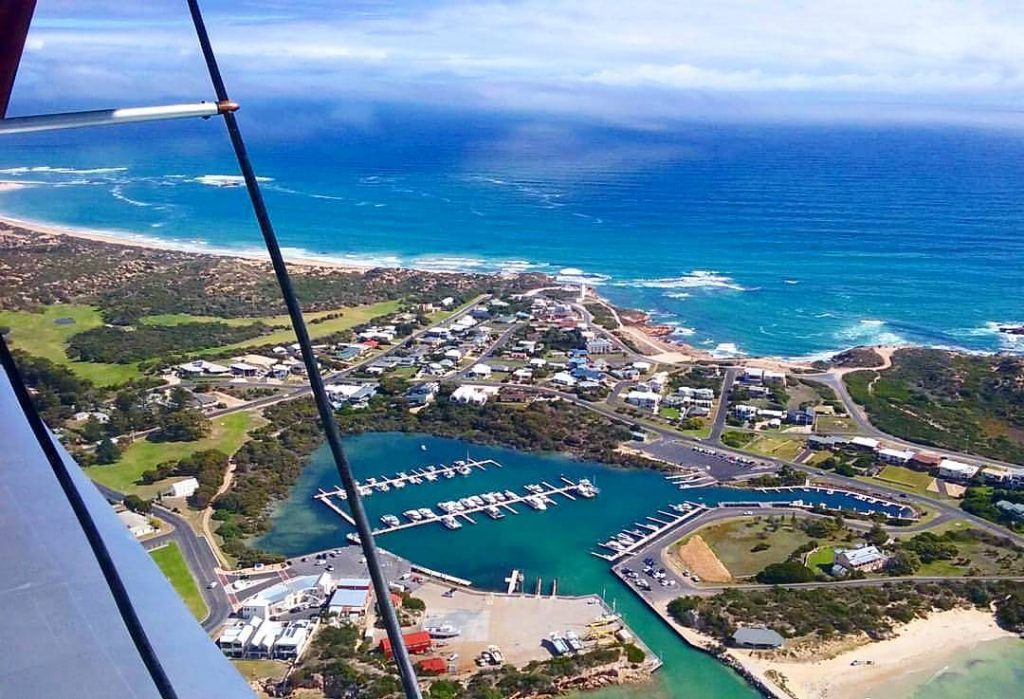
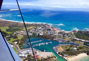
The lakes and the channel are an important landmark in Robe and are well utilised for recreation by visitors and local inhabitants. Dense thickets of paperbark and T-tree abound and these are important wildlife habitats. An appreciation of the immensity of the drainage works can be further gained from a visit to Drain L Lookout which overlooks the Woakwine Cutting on Drain L.
Historic Interpretive Centre
An obvious starting point the Historic Interpretative Centre is located in the Library Building in Smillie St. The centre which was built as a library in 1868 and been recently modernised contains an extensive visual history of the district. It is open Mon – Fri 10.00 a.m. – 12.30 p.m. and 1.30 p.m. – 5.00 p.m. and on Saturday from 8.30 a.m. – 12.30 p.m.
Historic Walk
Available at the Historic Interpretative Centre is a very handy brochure which lists a total of 45 places of interest (including the Ambulance station and the Boat Ramp) in the local area. It includes descriptions of:
Lakeside
An elegant residence on the shores of Lake Fellmongery and on the main road into town which was built by George Danby (real name: George Affleck) the youngest son of a clergyman, Sir Robert Affleck. He changed his name to Danby so he could inherit the Danby Estate but was such a huge spender that he managed to go through his inheritance and the Danby fortune before he died.
For those who are interested ‘Fellmongery’, as in Lake Fellmongery, means ‘woolwash’. A ship, the ‘Duilius’, carrying a cargo of wool was shipwrecked in Guichen Bay in 1853. The cargo was salvaged but it was full of salt water. It was subsequently washed in the lake and when it arrived in England it fetched a higher price. Subsequently local wool exporters decided to wash wool in the lake and fellmongery works was established on the banks of the lake.
The Lodge and The Old Cottage
Located on opposite corners where Main Road crosses Squire Drive these two buildings are over 100 years old. The Lodge was built in 1850 as a Butcher’s shop and the Old Cottage was the home of Andrew Munro who, in the early days, used to light the beacon lighthouse
Caledonian Inn
This historic building was completed in 1859 by a Scot, Peter McQueen. It achieved fame when the poet Adam Lindsay Gordon, having fallen from a horse, recuperated at the Inn. He was nursed by the innkeeper’s daughter, Margaret Park, and the two subsequently married.
Robe Hotel
Located on Mundy Terrace the Robe Hotel was originally known as the Bonnie Owl. The Bonnie Owl, which is now in ruins, dates from 1847. It has been replaced by the handsome two-storey Robe Hotel which is a feature of the main road along the town’s beach.
Magnetic Telegraph Station
Located nearby on Mundy Terrace is the old Magnetic Telegraph Station and Post Office (now a private residence) which was designed by the Colonial Architect, C.A. Perry, and built in 1858. This was the year the telegraph line from Adelaide to Melbourne was opened. It ensured Robe’s importance in the early communications between Victoria and South Australia.
Royal Circus
The Royal Circus is located at the point where the first survey line for Robetown was established. It has the advantage of being not only the focus of the town but also being large enough to allow the bullock drays to turn around as they brought their produce to the port. There are a number of places of historic interest nearby.
Robe Customs House
The Robe Customs House is centrally located at the Royal Circus and is open daily during January from 2.00 p.m. – 4.00 p.m. At other times of the year it is open from Tuesday to Saturday from 2.00 p.m. – 4.00 p.m. It is an attractive limestone building with brick quoins which was built in 1863 to cater with the large number of Chinese passing through the port. It later become the local council chambers and in 1969 was converted into a museum. For more information contact (08) 8768 2419
Chinese Monument
Near the Customs House is a monument to the Chinese: ‘During the years 1856-58 16,500 Chinese landed near this spot and walked 200 miles to Ballarat and Bendigo in search of gold.’
Monument to Matthew Flinders
In the centre of the Royal Circus is a monument to Matthew Flinders who surveyed the coast and on 13 April 1802 named the Baudin Rocks after the commander of the French expedition. This was the last place name applied by Flinders in South Australia.
Koenig Cannon
An interesting old cannon which stands on the shore pointed out to sea at some imaginary enemy.
Star of the Sea Roman Catholic Church
The local Catholic Church stands near the shores of Boat Haven just inland from the Royal Circus. It was completed in 1859 and for many years two small rooms at the western end of the church operated as the town’s Catholic school.
Moorakyne
George Ormerod was one of the town’s most prominent citizens. He built both the Grey Masts Woolstore (located on the corner of Smillie and Davenport streets) and the Ormerod Cottages (the former Barracks) and around 1856 he built Moorakyne House (it can be found at the southern end of Hagen Street) a handsome 12-room residence made out of local stone.
It is characterised by bargeboards, large stone lintels and a range of interesting outbuildings including a stone coach-house. Ormerod was admired by the local citizens because of his commitment to local produce. In the decade between 1855-66 nearly £2 million worth of goods passed through his export company.
Karatta House
On the western side of Boat Haven (which is also known as Lake Butler) is Karatta House, a substantial stone mansion which was built by pastoralist Henry Jones in 1860. It was subsequently used as a holiday house by Sir James Ferguson, a one-time Governor of South Australia in the 1870s.
The Old Gaol
Heading towards the Obelisk and Cape Dombey you will notice the ruins of the old gaol. A stone building was constructed here in 1861 but it was never fully completed and consequently it was closed in 1881 and subsequently fell into disrepair. Parts of it were demolished and used for road gravel in the local area.
Obelisk on Cape Dombey
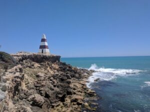
A prominent landmark in Robe (drive around Boat Haven and continue west to the headland) the Obelisk was originally built to help shipping. At one point it was used to store rockets which were fired to people in distress. An early problem was that it was originally painted white and sailors complained that by the time they could see the obelisk they were already too close to the rocks which stretch for nearly 2 km from the base of the cliffs.
It was built from stone which was carted to the headland by bullock teams. The original building was completed in 1855 by a local builder. It is painted red and white and stands 13 metres above the surrounding ground which means it is 33 metres above sea level. It can be seen for 15 km off the coast. It is amusing to recall that when Matthew Flinders first sighted Cape Dombey in 1802 he described it as ‘a point of moderate elevation, sandy but mostly covered with bushes’. He would be surprised if he could see it today.
Offshore from the headland it is possible to see the interesting Doorway Rock, an unusual coastal limestone formation.
Narraburra Woolshed
This is a working woolshed where, when shearing is occurring, you can see sheep dogs in action, shearers, wool sorting and wool baling. It is located on Penola Rd and people planning to visit must contact (08) 9768 2083 for opening times.
Little Dip Conservation Park
Located 4 km south of Robe Little Dip Conservation Park can be entered from Nora Criena Scenic Drive or Beacon Hill Lookout. It is ideal for bushwalking boasting a rich diversity of birdlife as well as attractive sand dune formations which fringe small beaches and substantial salt and freshwater lakes. There are plenty of rock pools to explore and beaches to walk along. It is a fine example of some of Australia’s most pristine coastline.
Tourist Information
Robe Library
Victoria St, Robe SA 5276
Telephone: (08) 8768 246
__________________________________________________
This post was reprinted from www.traveller.com.au
Read more: http://www.traveller.com.au/robe-south-australia-travel-guide-and-things-to-do-12zqb8#ixzz54dQLkaRw

